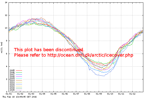
Current Sea Ice extent
Total sea ice extent on the northern hemisphere since 2005. The ice extent values are calculated
from the ice type data from the Ocean and Sea Ice, Satellite Application Facility
(OSISAF), where areas with ice concentration
higher than 30% are classified as ice.
The total area of sea ice is the sum of First Year Ice (FYI), Multi Year Ice (MYI) and the area
of ambiguous ice types, from the OSISAF ice type product. However, the total estimated ice area
is underestimated due to unclassified coastal regions where mixed land/sea pixels confuse the
applied ice type algorithm. The shown sea ice extent values are therefore recommended be used
qualitatively in relation to ice extent values from other years shown in the figure. In
late 2012 sea ice climatology and anomaly data will be available here.
|

Sea ice extent in recent years (in million km2) for the northern hemisphere,
as a
function of date.
Please notice, that the sea ice extent in this plot is calculated with the coastal
zones masked out. To see the absolute extent, go to this page.
An appearent divergence between ice extent algorithms is an artifact - read the explanation here.
|

