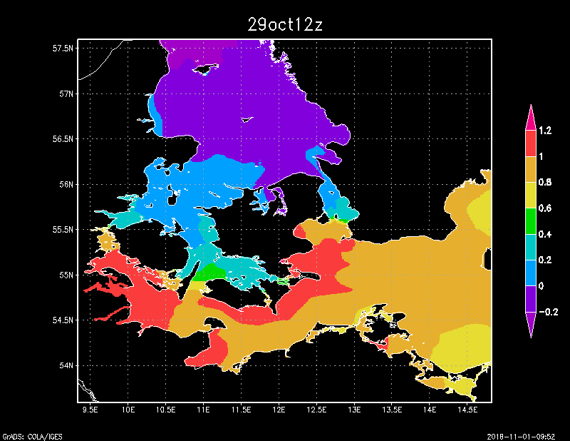
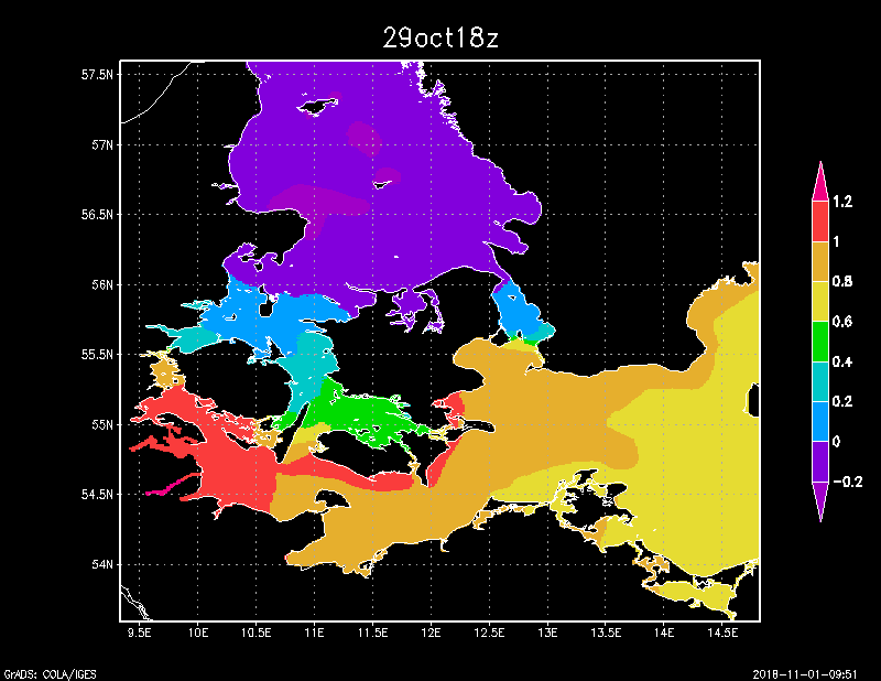
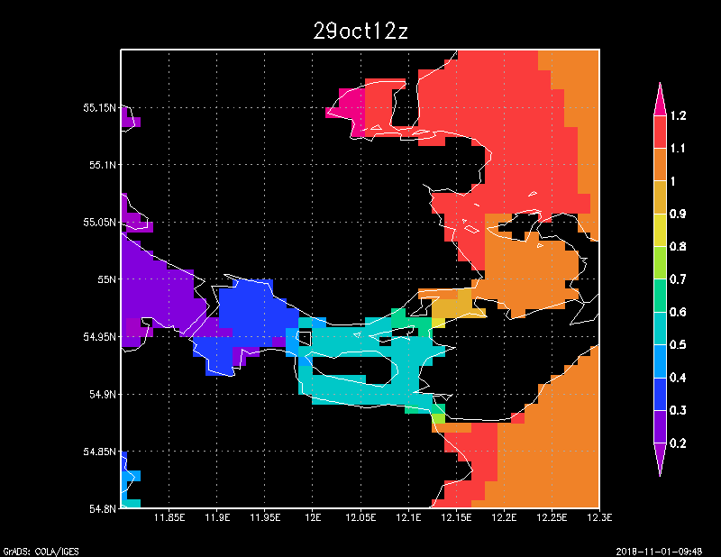
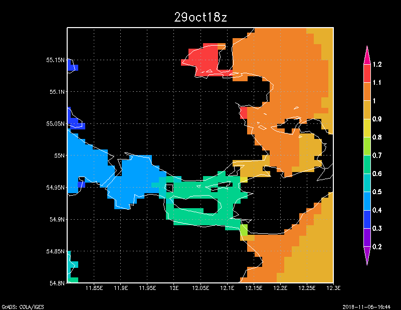
This is domestic sea level as predicted by HBM/DKSS at 12z and 18z, Oct 29th. The situation remains pretty static throughout the afternoon. Low water in the Kattegat ensures that the Western Baltic situation does not become too critical. There are rather sharp gradients at Drogden (Øresund), Kalvehave (Storstrømmen), and Snævringen (Little Belt). There is a less sharp gradient in the southern Great Belt.
Here we zoom in on Little Belt. Note the sea level drop of ~80cm from south to north through Little Belt, with Kolding at the fjord bottom. (Not same colour scale as full map).
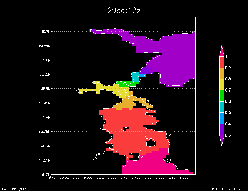
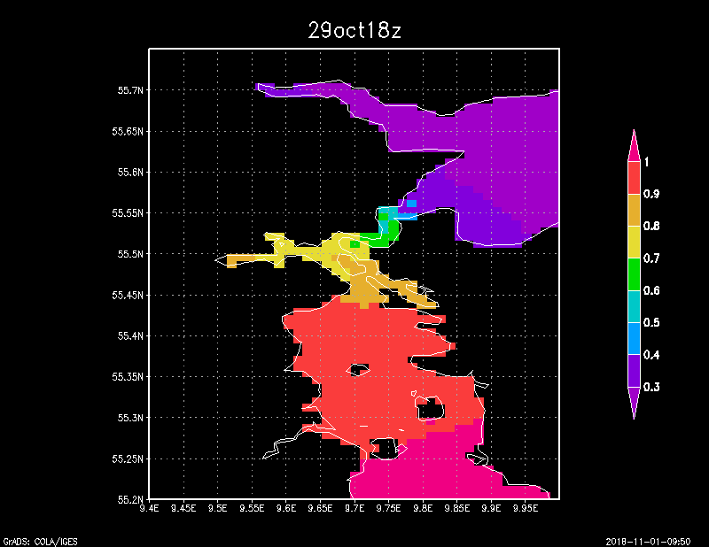
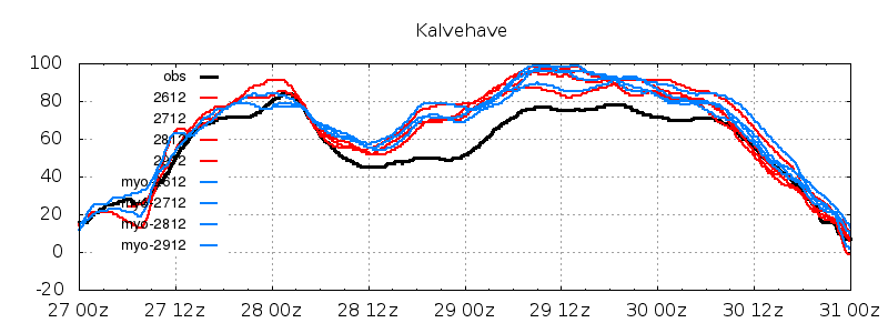
Here we zoom in on Storstrømmen. Note the gradient between Sjælland and Møn, pretty much exactly where Kalvehave is located. East of Møn, sea level has peaked and begins to drop off. Smålandsfarvandet, between Falster and Sjælland, slowly fills up. (Not same colour scale as full map).
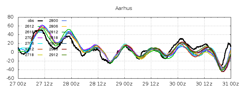
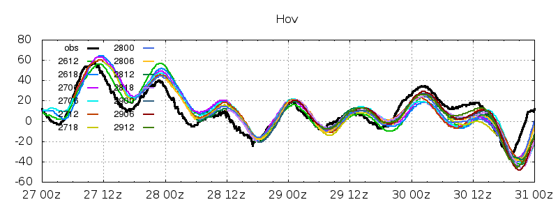
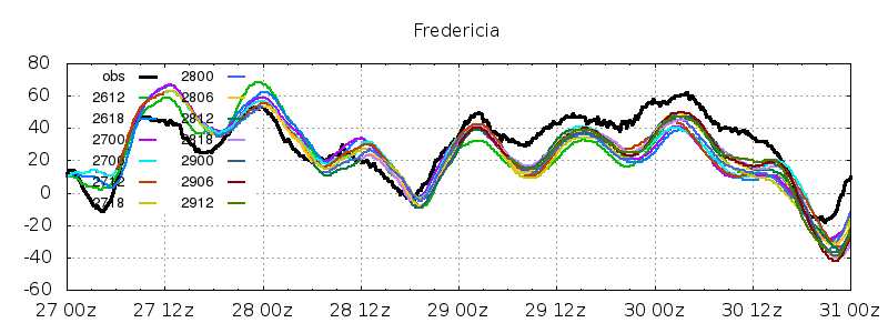
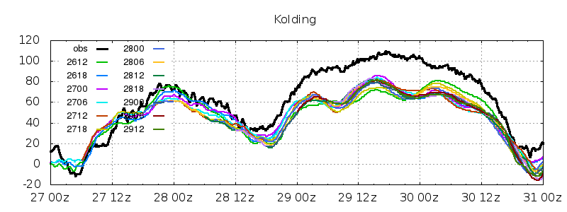
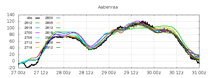
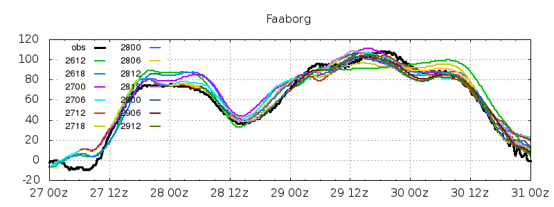
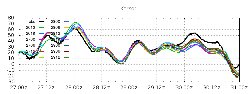
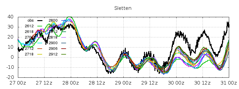
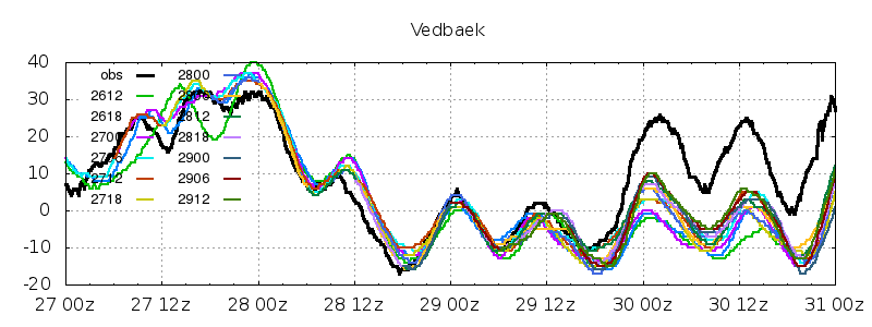
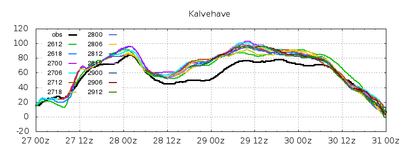
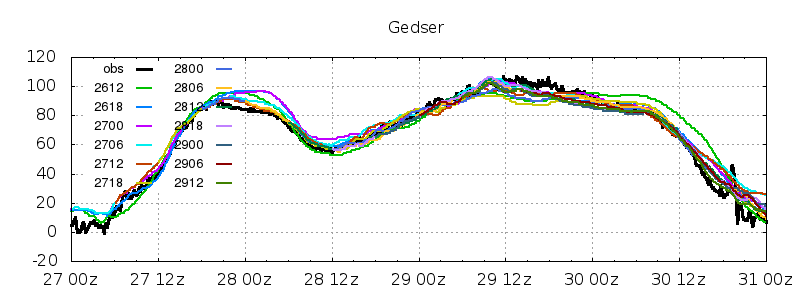
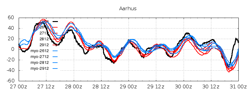
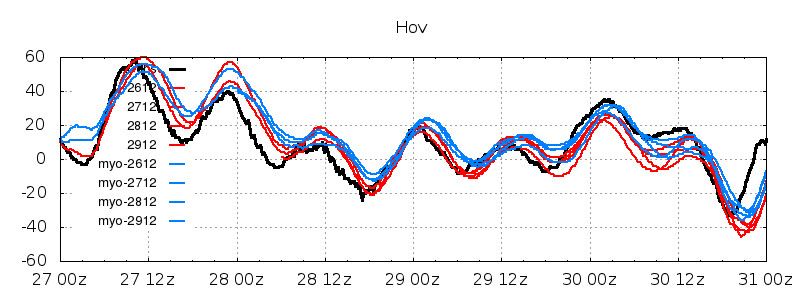
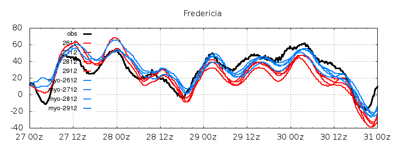
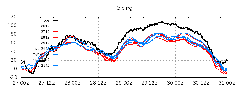
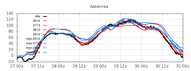
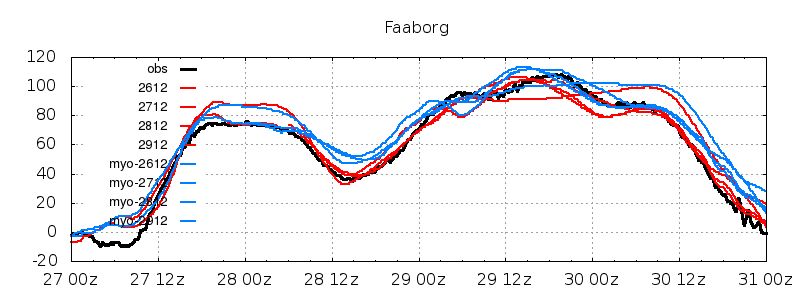
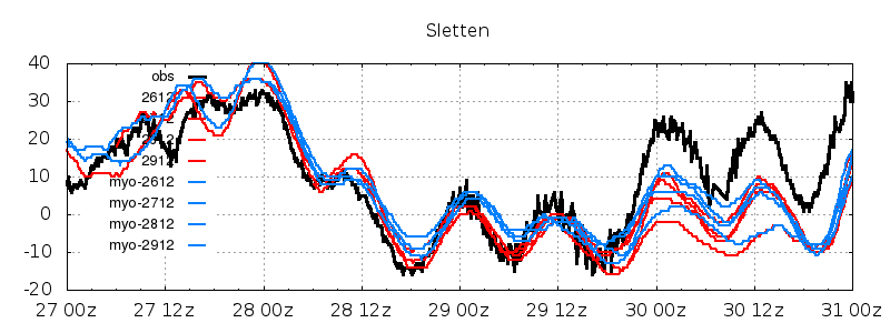
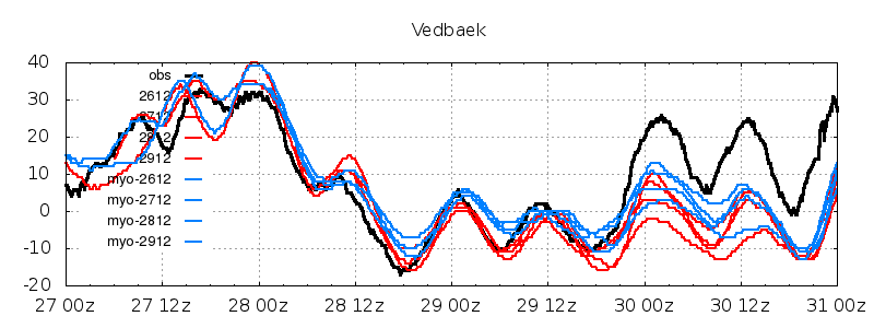
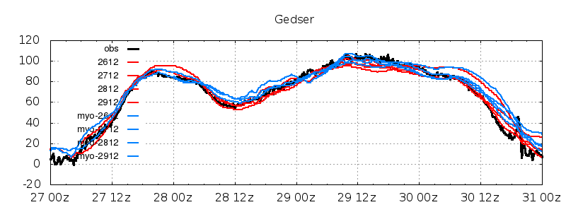
Predicted and observed sea level at 11 stations: Aarhus, Hov, Fredericia, Kolding, Åbenra, Fåborg, Korsør, Sletten, Vedbæk, Kalvehave, Gedser. Forecasts issued from Oct 16th 12z to Oct 29th 12z, 13 in total.
The forecasts remain stable, with not too much variability from forecast to forecast. There are two exceptions: the pre-phase in Øresund (Sletten, Vedbæk) on Oct 27th, and the Oct 26th 12z forecast, which has a peculiar quasi-constant sea level at a number of stations. The forecast range for the high water event being more than 2½ days, so this part was based on ECMWF forcing. We perform noticeably better as soon as high resolution forcing is used (time ranges less than 2½ days).
During the high water, DKSS overpredicts at Kalvehave, underpredicts at Kolding - and similarly at Fredericia, where a high water is not experienced. In the relaxation phase, Kattegat stations plus Kolding/Fredericia on Oct 30th, dkss underpredicts in general. (Note that the sea level axi range varies from station to station).
The MyOcean setup, run twice daily for project purposes, differs from DKSS in several ways. In MyOcean, the North Sea and Baltic Sea are separate model domains. The MyOncea Baltic domain has extra vertical resolution. Furthermore, MyOcean uses a HBM version of age ~1 year, DKSS of age ~6 years. Finally, MyOcean includes tidal potential while DKSS does not.
Shown is DKSS (red) and MyOcean (blue) predicted, and observed sea level at same 11 stations. Forecasts issued at 12z from Oct 16th 12z to Oct 29th 12z, 4 in total for each model.
There are some differences to notice. For stations not impacted by this high water, MyOcean forecasts tend to be higher during this event. For stations where warnings were either issued or nearly issued, this is not the case - the predicted high waters are similar. The low waters are generally better captured by DKSS.

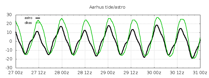
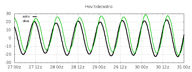
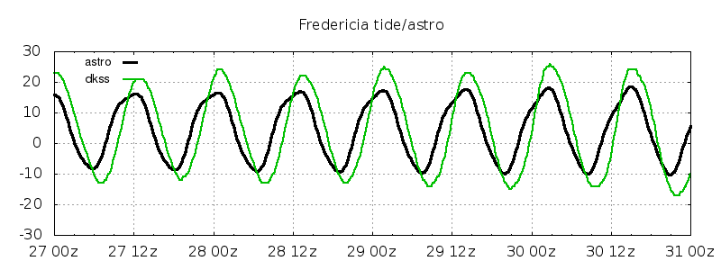
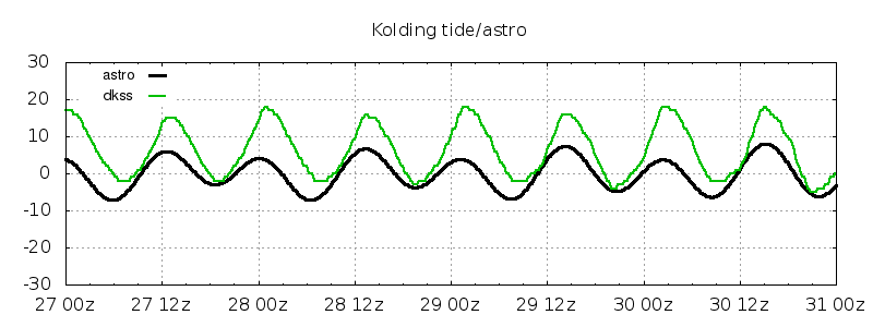
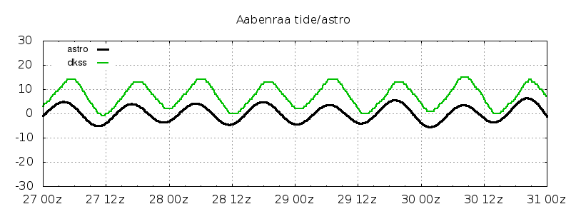
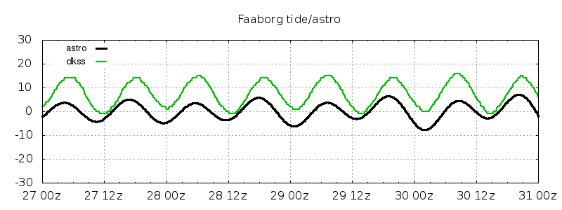
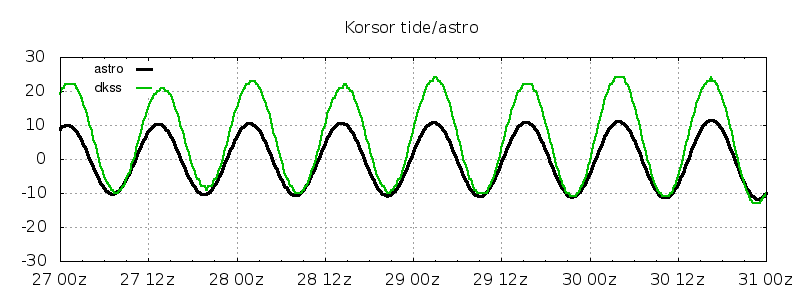
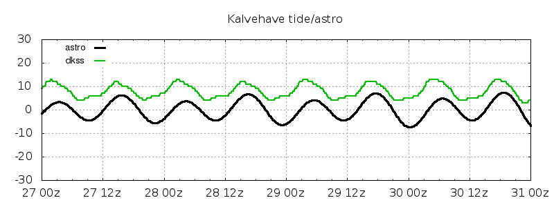
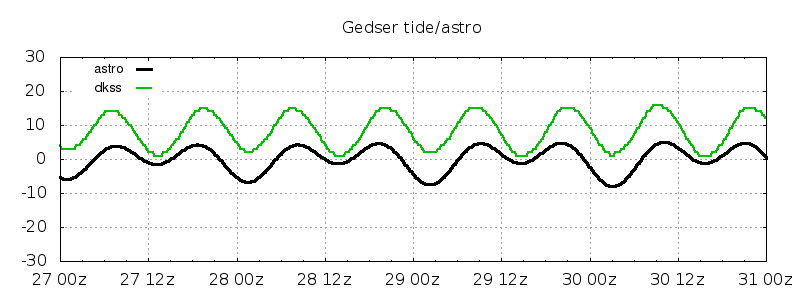
Four days of astronomical and modelled tide and observed sea level at same 11 stations, except Sletten where a tidal analysis has not yet been carried out due to its being a new station.
The astronomical and model reference levels do not to everywhere be the same. It should be noted that since the tidal signal in itself is small, so are the deviations, of the order of 10 cm.
In Kattegat, the model tide tends to be stronger than the astronomical, and somewhat delayed. In the Western Baltic, the astronomical tide has a diurnal signal, seen as alternating weak and strong hi/lo waters. This is most clearly seen at Gedser, less so at Kalvehave, Fåborg, Kolding. This effect is absent in the model tide, and therefore also in the DKSS forecast. The reason for this is believed to be that the model has only tide of Atlantic origin, and the diurnal signal stems from the tidal potential within the Baltic.
The deviation from a harmonic sine curve observed at Fredericia and Århus is not captured by the model tide. In Fredericia, observed high waters level off while model tide does not. The relation is opposite at kolding and Kalvehave. Here, the model tide is distorted, while the observed tide is a blend of two harmonics: diurnal and semi-diurnal.


Jacob W Nielsen, nov 5th 2018