DMI operates a regional 3D ocean model BSHcmod for the North Sea - Baltic,
in order to provide information about the physical state of the Danish and nearby waters in the near future.
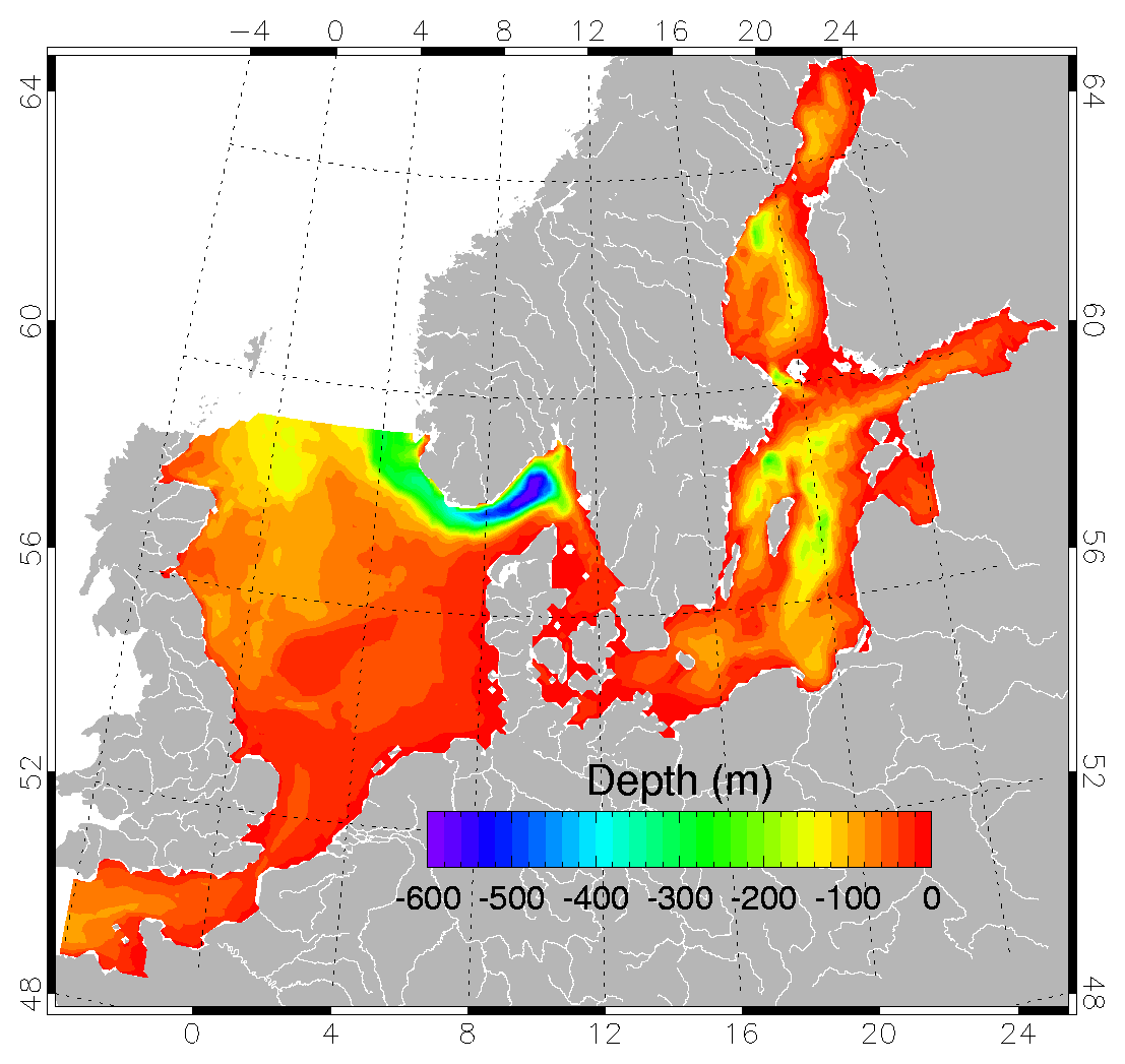
The Figure to the right shows the model domain for the 3D grid.
The parameter shown is the water depth.
Model code
The BSHcmod code was developed in the early 1990'ies
at
Bundesamt für
Seeschifffahrt und Hydrographie (BSH) in Hamburg, Germany.
It has undergone extensive revision in the DMI implementation.
Basically the same code is used in the Baltic HIROMB co-operation, where the Danish
institute
Danish Maritime Safety Administration participates.
Input
Three types of input is applied: surface fields, point sources, and open boundary conditions.
Heat flux through the sea bed is parameterized.
BSHcmod is forced by DMI's numerical weather prediction model
DMI-HIRLAM.
The following parameters are used:
- 10 metre wind speed and direction
- mean sea level atmospheric pressure
- surface (2 metre) air temperature
- surface air (2 metre) humidity
- cloud cover
BSHcmod calculates Surface energy fluxes (mechanical, radiative, thermodynamic) using
bulk parameterisation formulae.
Point source data are
- freshwater fluxes from 79 rivers
- nutrient from the same rivers (optional)
Open boundary data are:
- tidal sea surface elevation
- monthly climatological hydrography
Data-assimilation
BSHcmod optionally assimilates one or more types of observered or modelled data:
- sea surface temperature from satellite
- vertical profiles of hydrography
- daily open boundary hydrography data
This facility has not been put in operational use as of yet.
Schedule
BSHcmod runs every 6 hours, i.e. 4x/day. A run produces a 5 day forecast
of the 3-dimensionel state of the ocean.
Output
BSHcmod calculates
- sea level
- water temperature
- salinity
- ocean currents
- ice thickness and concentration
at 15 min.intervals. Temperature, salt and current is calculated
for the entire water column, top to bottom, at ~ 50 fixed depth levels. Sea level at selected, coastal points is calculated in 10 minute time resolution.
Output parameter table.
Model set-up
The DMI-BSHcmod model set-up consists of 5 model domains:
- NOAMOD - 2-dimensional mesocale model, that calculates sea level as a function of
wind speed and air pressure. Generates boundary data (external surge)
for the regional 3-dimensionan model
- North Sea - Baltic Sea - 3-dimensional regional model with subdomains
- Transition Area - high resolution model of the waters south of Skagen and west of Bornholm
- Wadden Sea - high resolution model of the Germasn Bight
- Limfjord - high resolution fjord (appended) model (lacks run-off data)
| Model |
NOAMOD |
BSHcmod
North Sea - Baltic Sea |
BSHcmod
Transition Area |
BSHcmod
Wadden Sea |
BSHcmod
Limfjord |
| Spatial resolution |
6' lat 10' lon
(6 n.m.) |
3' lat 5' lon
(3 n.m.) |
30" lat 50" lon
(0.5 n.m.) |
1' lat 1'24" lon
(1 n.m.) |
12" lat 20" lon
(0.2 n.m.) |
| Vertical layers |
1 |
50 |
52 |
24 |
9 |
| Max. top layers thickness |
900m |
8m |
2m |
8m |
2m |
Time step:
Barotropic
Baroclinic:
Ice |
15s
-
- |
30s
90s
900s |
15s
90s
900s |
30s
90s
900s |
10s
20s
900s |
| Atm. forcing |
Hirlam T15 |
Hirlam S03 |
Hirlam S03 |
Hirlam S03 |
Hirlam S03 |
| Area: longitude |
21W-13E |
4W-30E |
9E-15E |
6E-10E |
8E-10E |
| Area: latitude |
48N-66N |
Baltic Sea: 48N-66N
North Sea: 48N-59N |
53N-57ẄN |
53N-56N |
57N-58N |
| Open boundaries |
Radiation condition |
- Surge contribution from NOAMOD
- tidal wave (17 constituents)
- monthly climatology fields for T and S via a sponge layer
|
nested in regional model |
nested in regional model |
boundary data from regional and transition area model |

