|
SHIPcAPP
Supporting sHIPping around CAPe Farewell with high resolution forecasting Products "Generated using E.U. Copernicus Marine Service Information " |
|
|
Copernicus Markets: Marine Navigation and Polar Environment Monitoring Copernicus Marine Service Region: Global Ocean - Atlantic Ocean |
|||
|
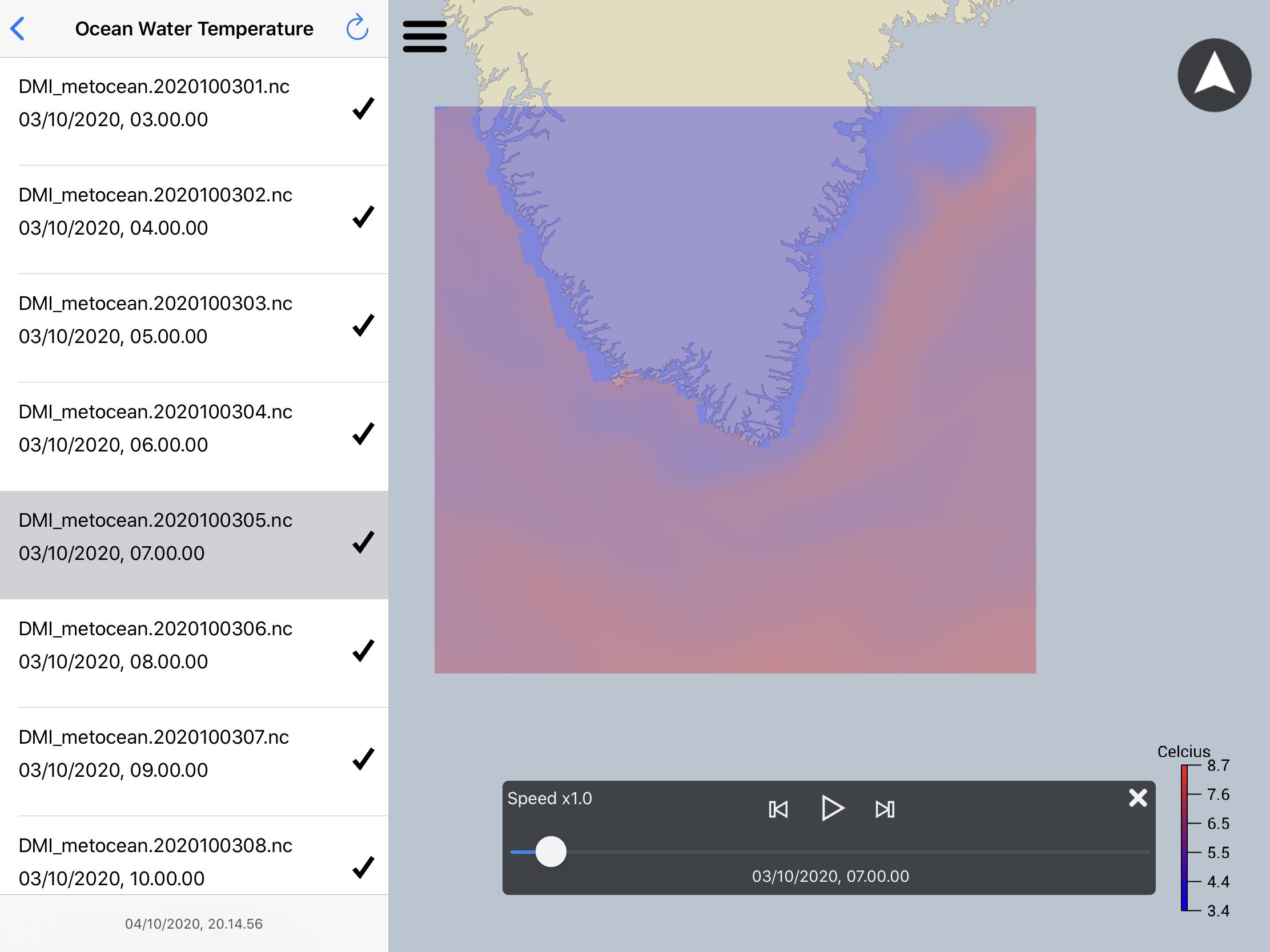
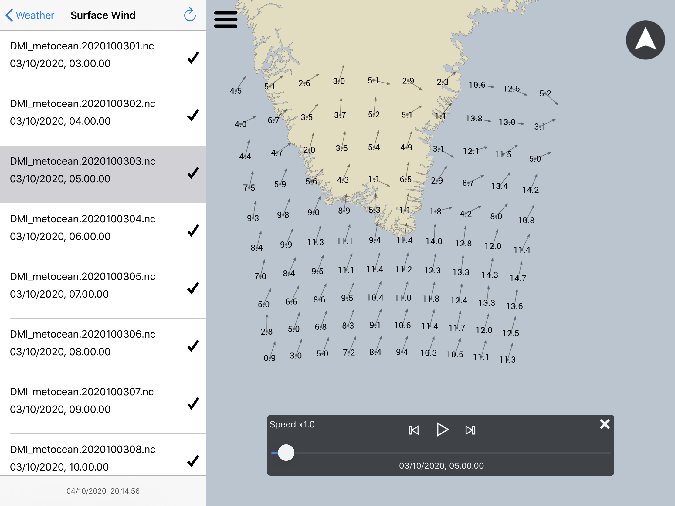
The SHIPcAPP service SHIPcAPP provides high quality information targeted for shipping through the app Neptune. The information is based on a high resolution forecast for the area around Cape Farewell on the southern tip of Greenland. The service improves the level of detail for metoc data ( wind, ocean and sea ice conditions). A key element of the service is the Copernicus Marine Service that provides multiple datasets that are necessary in order to provide this service. For this purpose the following services will be provided:
SHIPcAPP provides following parameters in high resolution
Targeted users The shipcapp service aim at providing high resolution meteorological and oceanographic information to the maritime users in the waters around Cape Farewell. This provides important knowledge about the wind, ocean and sea ice in the area of focus.The first users who indicated their interest are Royal Arctic Line and DanPilot who provided a letter of intent at the application state. In addition Greenland Ice Pilots have indicated their interest. Internally at DMI the Cape Farewell forecast support the Greenlandic Ice Charting, which also benefit the maritime users of these waters. At last Rocket Brothers benefits from improving Neptune (their visualization app with the capabillity of ingesting Copernicus Marine Service data products, which enhances the ability to use the full catalogue of data. |
|
|||
|
Ingestion of Copernicus Marine Services |
||||
|
The operational global forecast from Copernicus Marine Service is useful for forcing the high resolution nested domain. The large scale changes of the ocean and sea ice circulation is propagated through the boundaries and modified within the high resolution model that forecast local features with a resolution of approximately 1km for ocean and sea ice parameters around Cape Farewell. The wave forecast from the Copernicus Marine Service provides information about the wave climate, which is not included in the high resolution model. Automated and manually derived remotely sensed products are key elements when validating the forecast. The ice charts provides high resolution sea ice information derived by ice analysts. Surface temperatures and passive microwave sea ice products provides automated information about the surface of the ocean/ice. At last the atmospheric model is from DMI's own archive and it has a resolution of 2.5km |
||||
| Copernicus Marine Service data and their use | ||||
| Service (and link) | Short description | Fields used | ||
| GLOBAL OCEAN 1/12 ° PHYSICS ANALYSIS AND FORECAST UPDATED DAILY | Global forecast. SHIPcAPP utilizes the Global forecast as boundary conditions and initialization of the high resolution model setup. |
|
||
| ARCTIC OCEAN PHYSICS ANALYSIS AND FORECAST | Arctic Forecast. SHIPcAPP utilized this for the assessement of which of the forecast was best suited. The Global forecast was chosen. |
|
||
| ARCTIC OCEAN - SEA AND ICE SURFACE TEMPERATURE | Remotely sensed SST and ice surface temperature. Used for assimilation and/or validation of the regional forecast. |
|
||
| ARCTIC OCEAN SEA ICE CONCENTRATION CHARTS - SVALBARD AND GREENLAND | Ice charts for Greenland. Used for validation of the regional forecast and potentially assimilation into the regional forecast model. |
|
||
| GLOBAL OCEAN - ARCTIC AND ANTARCTIC - SEA ICE CONCENTRATION, EDGE, TYPE AND DRIFT (OSI-SAF) | Sea ice concentration based on passive microwave data |
|
||
| ARCTIC OCEAN WAVE ANALYSIS AND FORECAST | Arctic Wave model used to display the wave field |
|
||
| SAR Sea Ice Berg Concentration and Individual Icebergs Observed with Sentinel-1 | Iceberg detection for direct distribution |
|
||
| Data from SHIPcAPP is distributed on the following platforms | ||||
|
||||
SHIPcAPP News
Questions related to the Copernicus Marine Service can be emailed to: Copernicus Marine Service servicedesk The Copernicus Marine services can be found on: Copernicus Marine Service 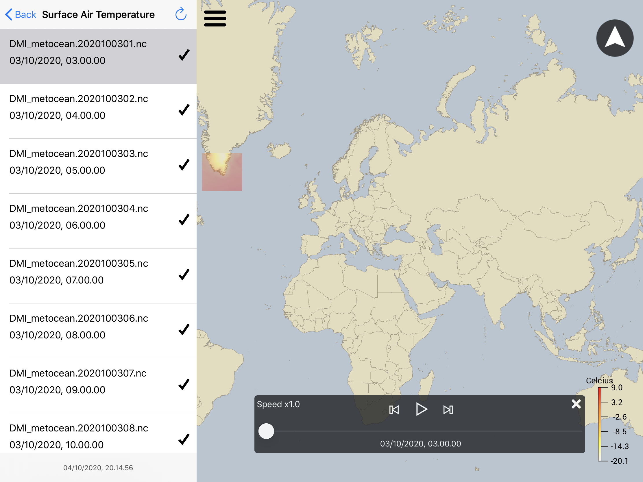
 How to install shipcapp
Demonstration of how to use app
|
||||

|
SHIPcAPP service developed in collaboration between Rocket Brothers and DMI.
"Generated using E.U. Copernicus Marine Service Information" / Ⓒ EUMETSAT (OSI-SAF) The service has been developed with support from Copernicus Marine Service User uptake. |