|
|

|
|
Automated sea ice concentration products
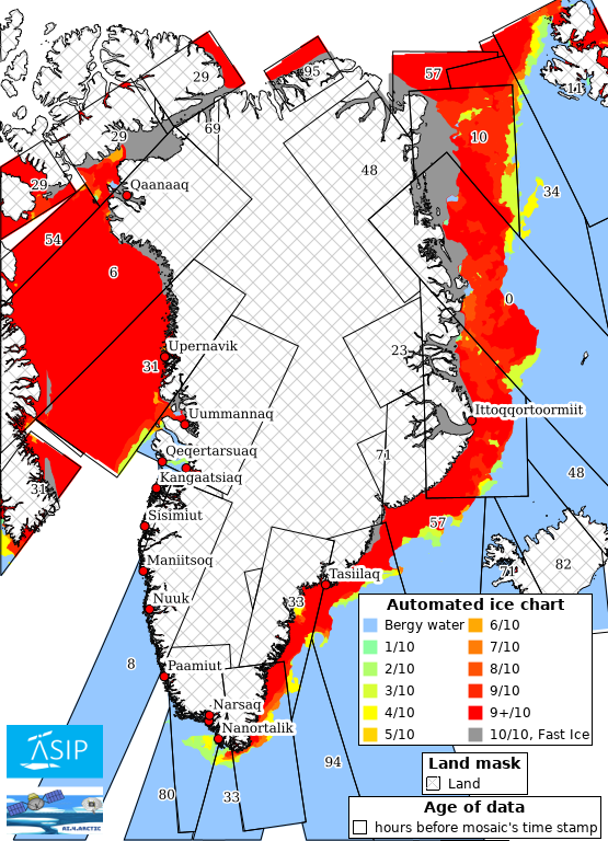
The ice information products shown below are automatically retrieved from radar (SAR) satellite images with ~80 m spatial resolution (Extra Wide swath mode) from the Copernicus Sentinel-1 satellite, combined with passive microwave data from the AMSR2 sensor onboard the Japanese GCOM-W satellite. The automated interpretation of the two satellite data sources is done using a convolutional neural network (CNN). More information about the method behind these automated ice products can be found at www.asip.dk. This service is developed by the projects ASIP (Innovation Fund Denmark) and AI4Arctic (ESA) Please be aware that this service is under development and that the current method is sensitive to certain weather conditions such as strong winds as well as satellite sensor noise which can lead to erroneous ice in the products. Likewise, the method has some limitations when detecting ice in the fjords. |
|
|
The figure below shows a mosaic of automated sea ice concentration products based on individual Sentinel-1 satellite images acquired within the last days, with the newest images on top. The numbers appearing inside the rectangles indicate the age of the individual images (hours before the mosaic's time stamp). Click on the figure to open a zoomable map to exploit the product details. |
|
|
08. April 2025 07:16 UTC
|
|