Northern Hemisphere Sea Ice extent
Monthly mean sea ice extent in the Northern Hemisphere since 1979. The sea ice extent data is composed by a Climate Data Record (CDR, 1979-2015), an Interim CDR (ICDR, since 2015 with 16 days delay) and a daily product to cover the period between the ICDR and today.
Click here for a detailed explanation.
Ice extent corresponds to the area where ice concentration is greater than 15%.
The data are available at the Ocean and Sea Ice Satellite Application Facility (OSISAF)
and are presented graphically here.
You can read technical and validation reports of the products here.
Possible differences between this sea ice extent estimate and other estimates are most likely caused by differences in the applied algorithms and in the definition of ice extent.
You can toggle between the sea ice extent values and their rankings through time with a left mouse click on the table.
Notice: The new version (v2.2) plots are based on OSI-SAF's new v3 sea ice climate data records (OSI-450-a, OSI-430-a), which can be read more about at: (OSISAFv3)
|
JavaScript - Changing images back and forth
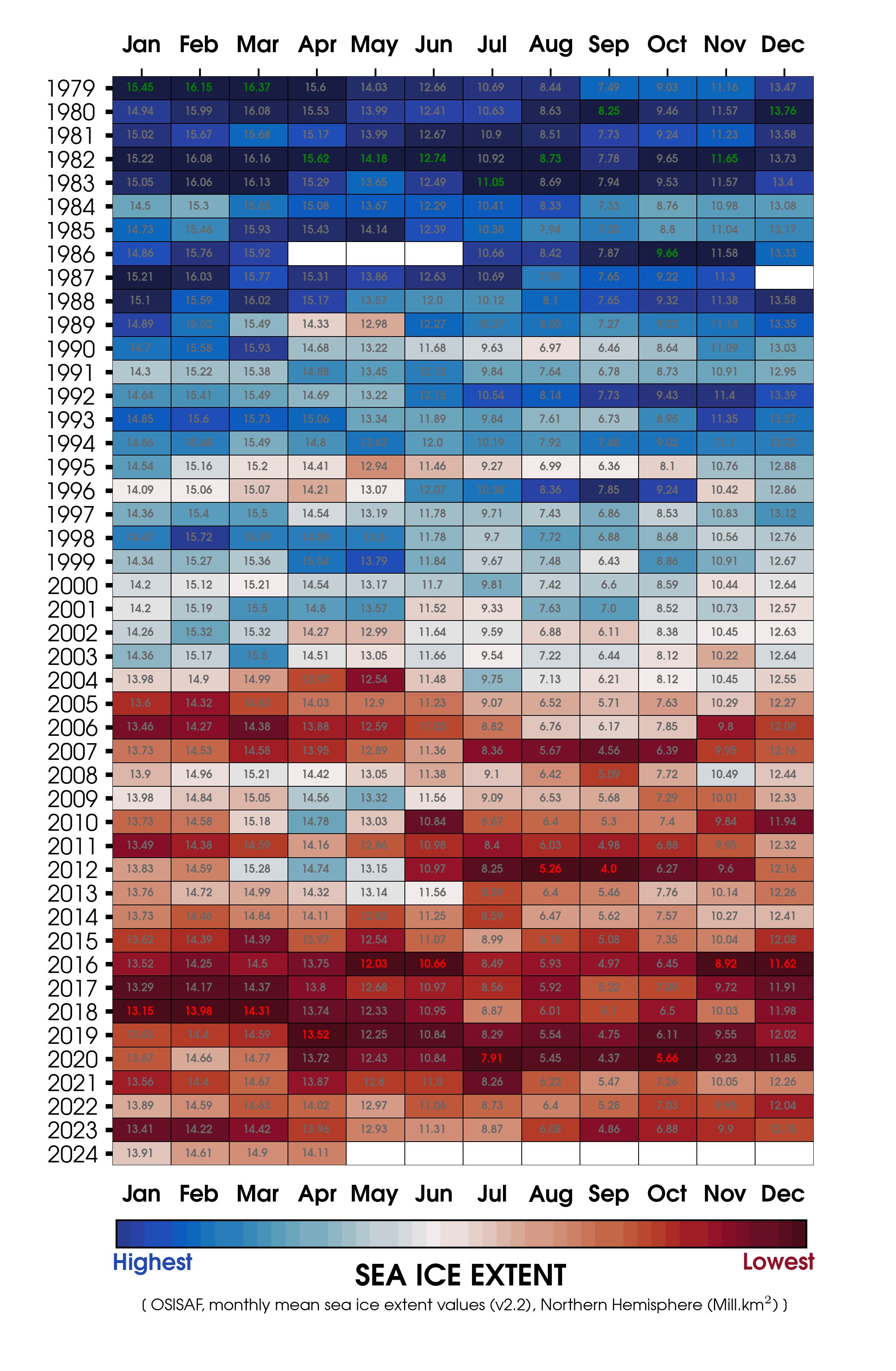 Monthly mean Sea Ice Extent since 1979, in the Northern Hemisphere. Ice Extent values are calculated from the latest OSI SAF climate data record (OSI-450), the interim climate data record (ICDR, OSI-430-b) and a Near-Real-Time (NRT) product (see links to the left). The monthly record-low values are red and the corresponding record-high values are green.
|
