Validation of the Operational Biogeochemical Model in the Baltic Sea
The 3D marine ecosystem model DMI/ERGOM is coupled with a high-resolution version of the DMI hydro-dynamical ocean forecast model DMI-BSHcmod for the Baltic Sea. ERGOM was originally developed to feature the Baltic Sea ecosystem, where ERGOM in coupling with the circulation model MOM 2 was calibrated/validated with observations sampled in 1980s for specific research purposes. In order to assess to what an extent the biogeochemical parameters of ERGOM are independent of the circulation model and observations to which ERGOM was calibrated, a more comprehensive data set sampled in the Baltic Sea after 2000 is used to validate a two-year simulation (2007-2008).
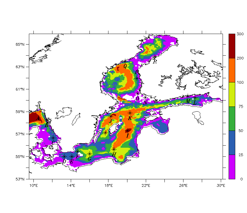
Fig. 1. Baltic part of the model domain, with observation stations
Results
The model results are compared with observations of surface water at the 18 stations indicated above. Red curves represent model simulation, cycled dash lines represent observations.
These comparisons are made for the annual cycle of nutrients, dissolved oxygen and phytoplankton in the surface and the bottom layer, and also for the overall pattern of temporal, vertical and horizontal variations.

Fig. 2: Seasonal variability of temperature in surface layer
Red solid curve (black dashed cycles) for model results (observations).
Unit: deg.C. Panels A-R for Stations A-R (Fig. 1), respectively.
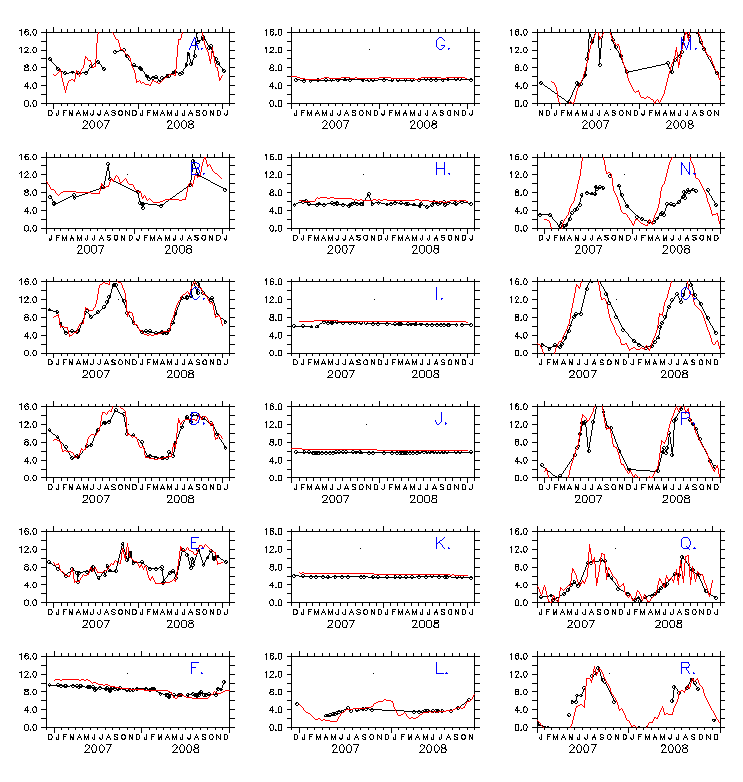
Fig. 3: Seasonal variability of temperature in bottom layer
Notations same as in Fig. 2.

Fig. 4 Seasonal variability of salinity in surface layer
Red solid curve (black dashed cycles) for model results (observations).
Unit: PSU. Panels A-R for Stations A-R (Fig. 1), respectively.
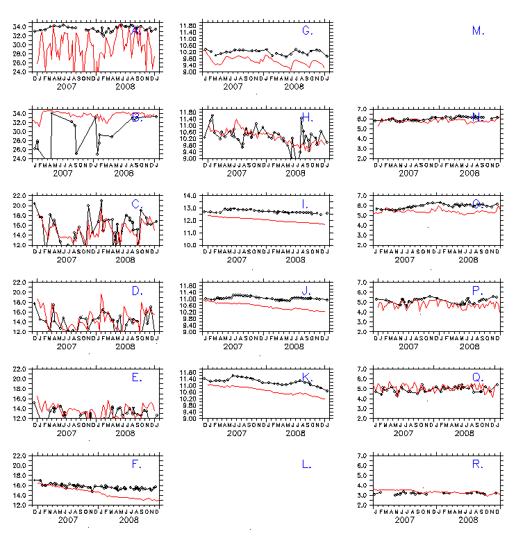
Fig. 5 Seasonal variability of salinity in bottom layer
Notations same as in Fig. 4.
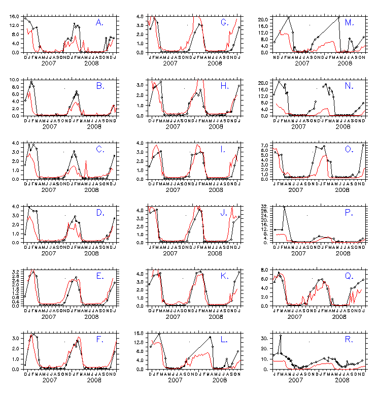
Fig. 6 Seasonal variability of DIN in surface layer
Red solid curve (black dashed cycles) for model results (observations).
Unit: mmol/m:3. Panels A-R for Stations A-R (Fig. 1), respectively.
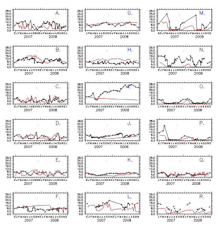
Fig. 7 Seasonal variability of DIN in bottom layer
Notations same as in Fig. 6.
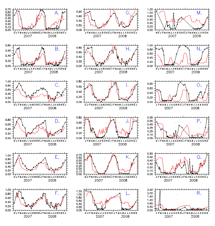
Fig. 8 Seasonal variability of DIP in surface layer
Notations same as in Fig. 6.
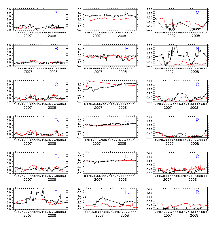
Fig. 9 Seasonal variability of DIP in bottom layer
Notations same as in Fig. 6.
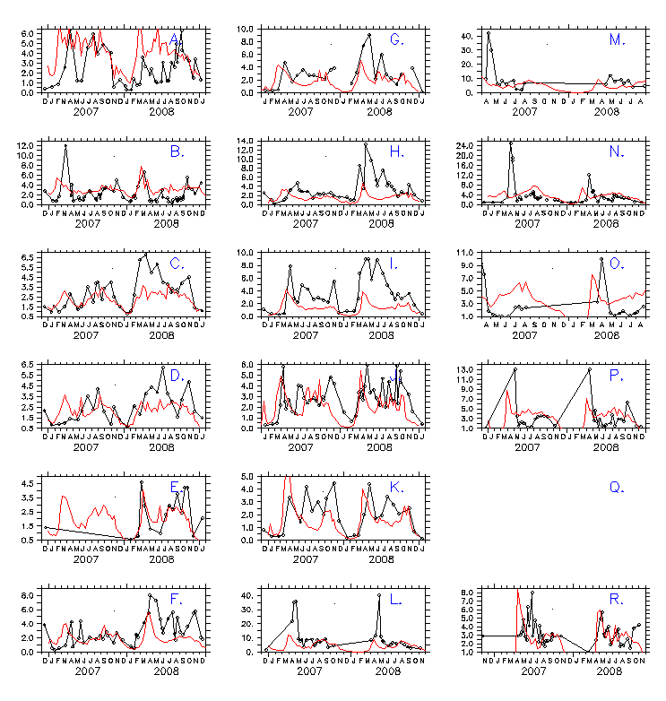
Fig. 10 Seasonal variability of Chl a in surface layer
Red solid curve (black dashed cycles) for model results (observations).
Unit: mg/m^3. Panels A-R for Stations A-R (Fig. 1), respectively.
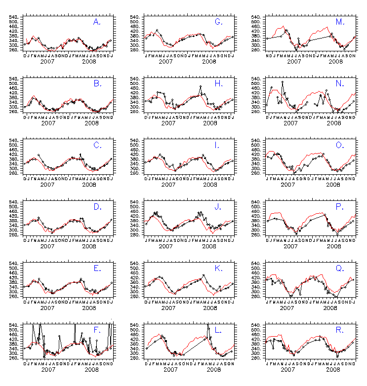
Fig. 11 Seasonal variability of DO in surface layer
Notations same as in Fig. 6.
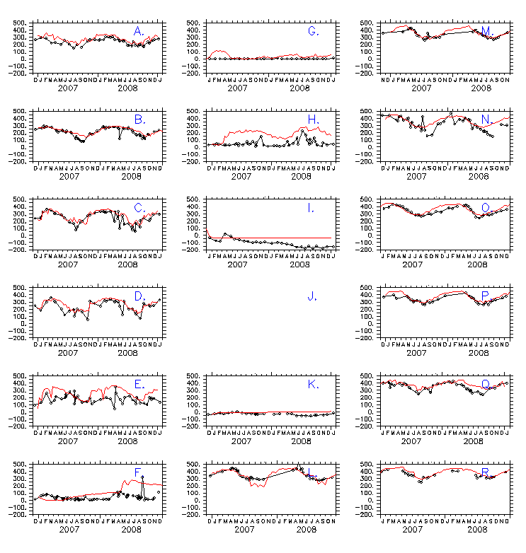
Fig. 12 Seasonal variability of DO in bottom layer
Notations same as in Fig. 6.
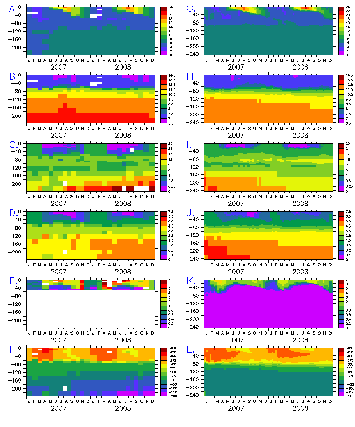
Fig. 13 Temporal evolutions of vertical profile in the Gotland deep at
station I
Panels A-F for observations of temperature, salinity, DIN, DIP, Chl a, DO,
respectively; Panels G-L for model results of them. Units: temperature -
deg.C; Chl a - mg/m^3; DIN, DIP, DO - mmol/m^3.
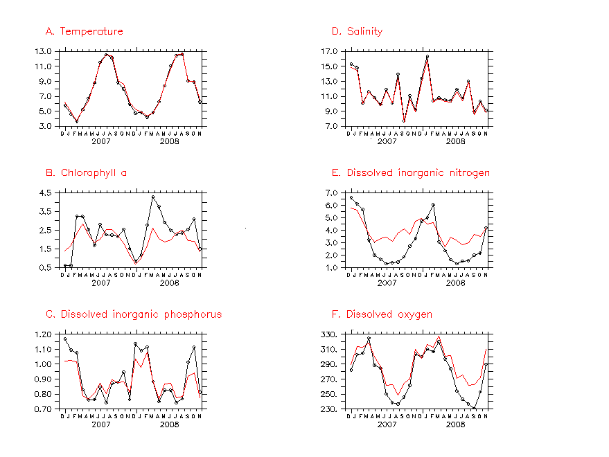
Fig. 14 Overall pattern of seasonal variability
Red solid curve (black dashed cycles) for model results (observations).
Panels A-F for, temperature, Chl a, DIP, salinity, DIN, DO, respectively.
Units same as in Fig. 13.
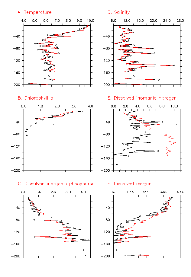
Fig. 15 Overall pattern of vertical profile
Notations same as in Fig. 14.
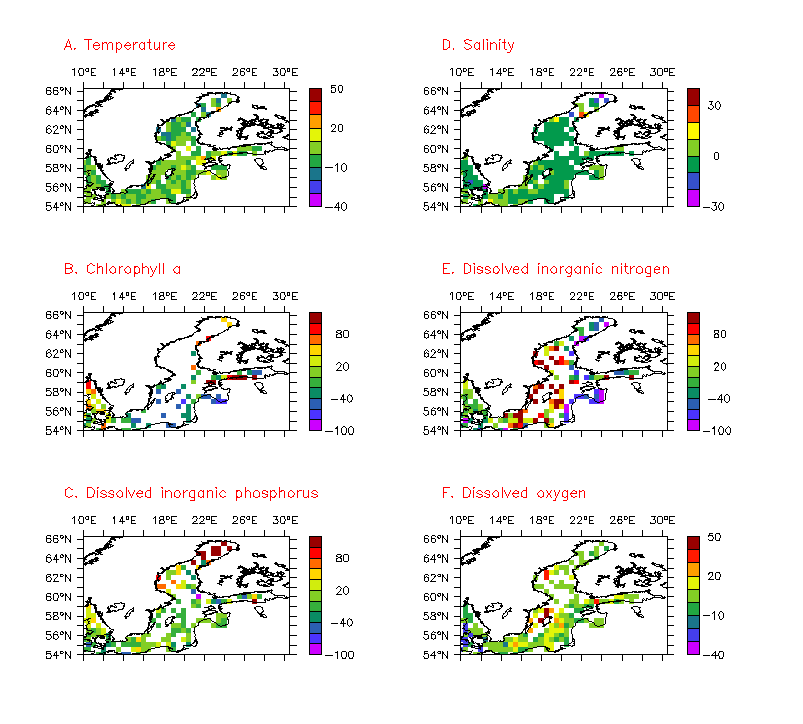
Fig. 16 Horizontal pattern of model's percentage errors
Panels A-F for, temperature, Chl a, DIP, salinity, DIN, DO, respectively.
Units %.
