Northern Hemisphere Sea Ice extent
Total sea ice extent on the northern hemisphere during the past years, including climate mean; plus/minus 2 standard deviations.
The ice extent values are calculated
from the ice type data from the Ocean and Sea Ice, Satellite Application Facility
(OSISAF), where areas with ice concentration
higher than 15% are classified as ice.
The total area of sea ice is the sum of First Year Ice (FYI), Multi Year Ice (MYI) and the area
of ambiguous ice types, from the OSISAF ice type product. The total sea ice extent can differ slightly
from other sea ice extent estimates. Possible
differences between this sea ice extent estimate and others are most likely caused by differences in
algorithms and definitions.
Data set
The sea ice extent data is composed by a Climate Data Record (CDR, 1979-2015), an Interim CDR (ICDR, since 2015 with 16 days delay) and a daily product to cover the period between the ICDR and today. Clic here for a detailed explanation.
You can read technical and validation reports here.
|
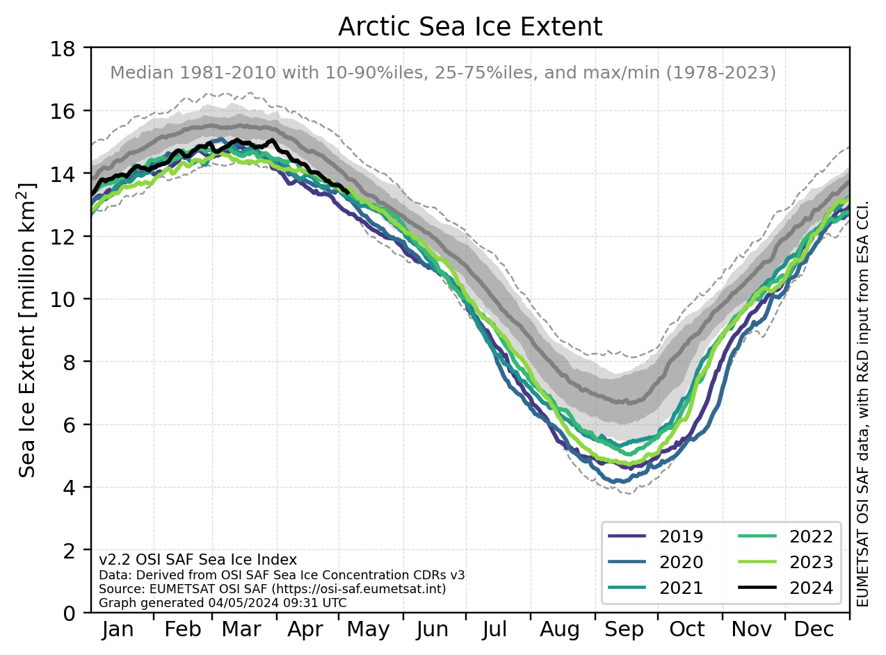
Sea ice extent in recent years for the northern hemisphere.
The grey shaded area corresponds to the climate mean
plus/minus 2 standard deviations.
|
