|
|
This site has been updated with an extension of the input data record. Moreover, minor changes and improvements have been made: - The input data record has been extended from 2015 to 2022.
- Climatology for the latest WMO's climate periode (1991-2020) has been calculated and added to ease comparison with other climatological products.
- The statistical significance of trends has been re-calculated, due to errors in the previous version.
- Plots and maps have been made bigger with a more contemporary look, to show more details.
- The statistics for the past 10 years has been removed, due to large statistical uncertainty.
More information of the applied data can be found here. The previous version of the climatology is still available here.
|
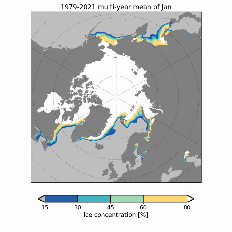
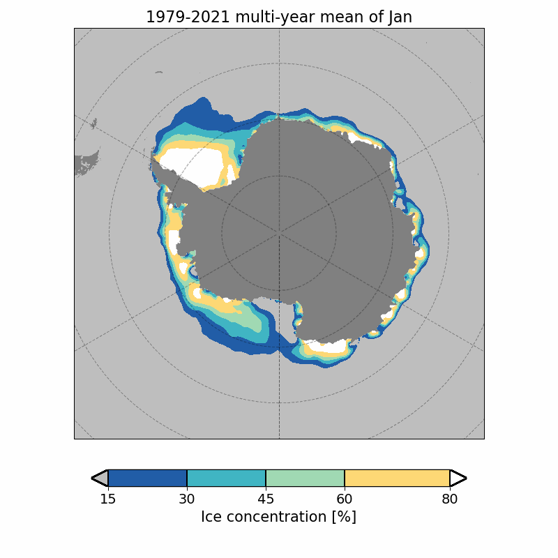
These maps show monthly mean sea ice concentration of the full data set period, 1979-2021.
Ice concentration is defined as the fraction of the sea surface which is covered by ice, where 100% corresponds to a complete ice cover and 0% corresponds to open waters. These maps are based on data from microwave satelites during the period from 1979 to 2022, which have been re-processed by the European project EUMETSAT OSI SAF into two data sets: a CDR from 1979 to 2020 and an ICDR from 2021 to 2022 (i.e. data set OSI-450-a and OSI-430-a). The sea ice typically reaches its maximum extent during March, extending approximately 14-16 million square kilometers, and its minimum extent by the end of september, which in the 1980's was approximately 7 million square kilometers compared to today's 3-5 million square kilometers.
|
Arctic |
|
| | | Toggle period |
| |
Jan |
Feb |
Mar |
Apr |
May |
Jun |
Jul |
Aug |
Sep |
Oct |
Nov |
Dec |
| |
| |  |
 |
In order to document OSI-SAF's impact and enable ongoing support of OSI-SAF, you are obligated to acknowledge OSI-SAF in your work. Therefore, if you wish to use any material presented here please read this file.
This page is a result of the sea ice concentration climatology. To download a summary data set climatology click here.
|
