|
|
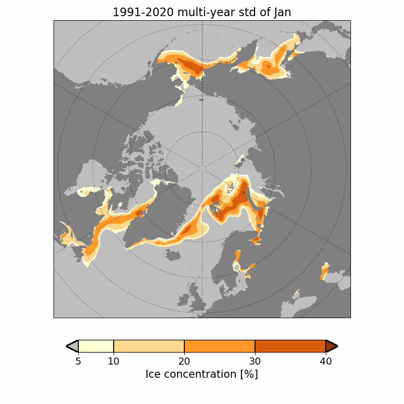
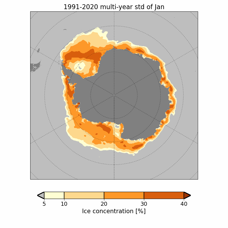
These maps show monthly variation (standard deviation) sea ice concentration of the wmo standard climate period, 1991-2020.
Ice concentration is defined as the fraction of the sea surface which is covered by ice, where 100% corresponds to a complete ice cover and 0% corresponds to open waters. These maps are based on data from microwave satelites during the period from 1979 to 2024, which have been re-processed by the European project EUMETSAT OSI SAF into two data sets: a CDR from 1979 to 2020 and an ICDR from 2021 to October 2024 (i.e. data set OSI-450-a and OSI-430-a). The sea ice typically reaches its maximum extent during March, extending approximately 14-16 million square kilometers, and its minimum extent by the end of september, which in the 1980's was approximately 7 million square kilometers compared to today's 3-5 million square kilometers.
|
Arctic |
|
| | | Toggle period
wmo-standard / full |
| |
Jan |
Feb |
Mar |
Apr |
May |
Jun |
Jul |
Aug |
Sep |
Oct |
Nov |
Dec |
| |
| |  |
 |
In order to document OSI-SAF's impact and enable ongoing support of OSI-SAF, you are obligated to acknowledge OSI-SAF in your work. Therefore, if you wish to use any material presented here please read this file.
This page is a result of the sea ice concentration climatology. To download a summary data set climatology click here.
|
